ACROSS
A Static and Dynamic Database for Accessibility in Historic Urban Contexts
Scientific Directors: Andrea Adami, Politecnico di Milano
Alberto Arenghi, Università degli Studi di Brescia
Enver Sangineto, Università degli Studi di Modena e Reggio Emilia
Collaborators: Barbara Scala, Sebastiano Marconcini, Daniele Treccani, Carlotta Coccoli, Olivia Longo, Yuwei Cao, Brandon Willy Viglianisi, Abel Getachew Assefa
Bando PRIN 2022-2026
The ACROSS project (PRIN 2022) addresses the challenge of physical accessibility in historic urban environments through an innovative, data-driven approach. Its aim is to support inclusive urban design and the management of built heritage by transforming accessibility into a measurable and analysable phenomenon. The project integrates geometric, semantic and dynamic information to describe urban space at multiple scales. It combines advanced geomatics techniques, GIS systems, and artificial intelligence methods, taking into account both permanent elements (such as gradients, level changes and materials) and variable ones (including temporary obstacles and evolving urban configurations). The outcome is a static and dynamic database that enables systematic evaluations and informs decision-making in urban planning, mobility and cultural heritage management.
Three universities collaborate on the project: the University of Brescia, responsible for theoretical models and principles of inclusive design; the Politecnico di Milano (Mantua Campus and Unesco Research Lab), focusing on 3D surveying and data integration within GIS platforms; and the University of Modena and Reggio Emilia, developing machine learning and deep learning algorithms.
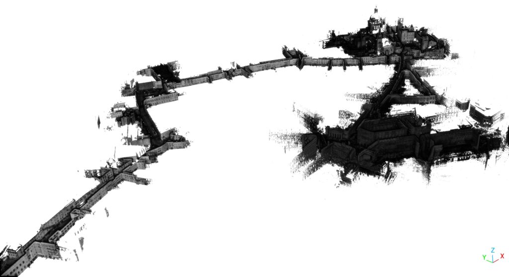
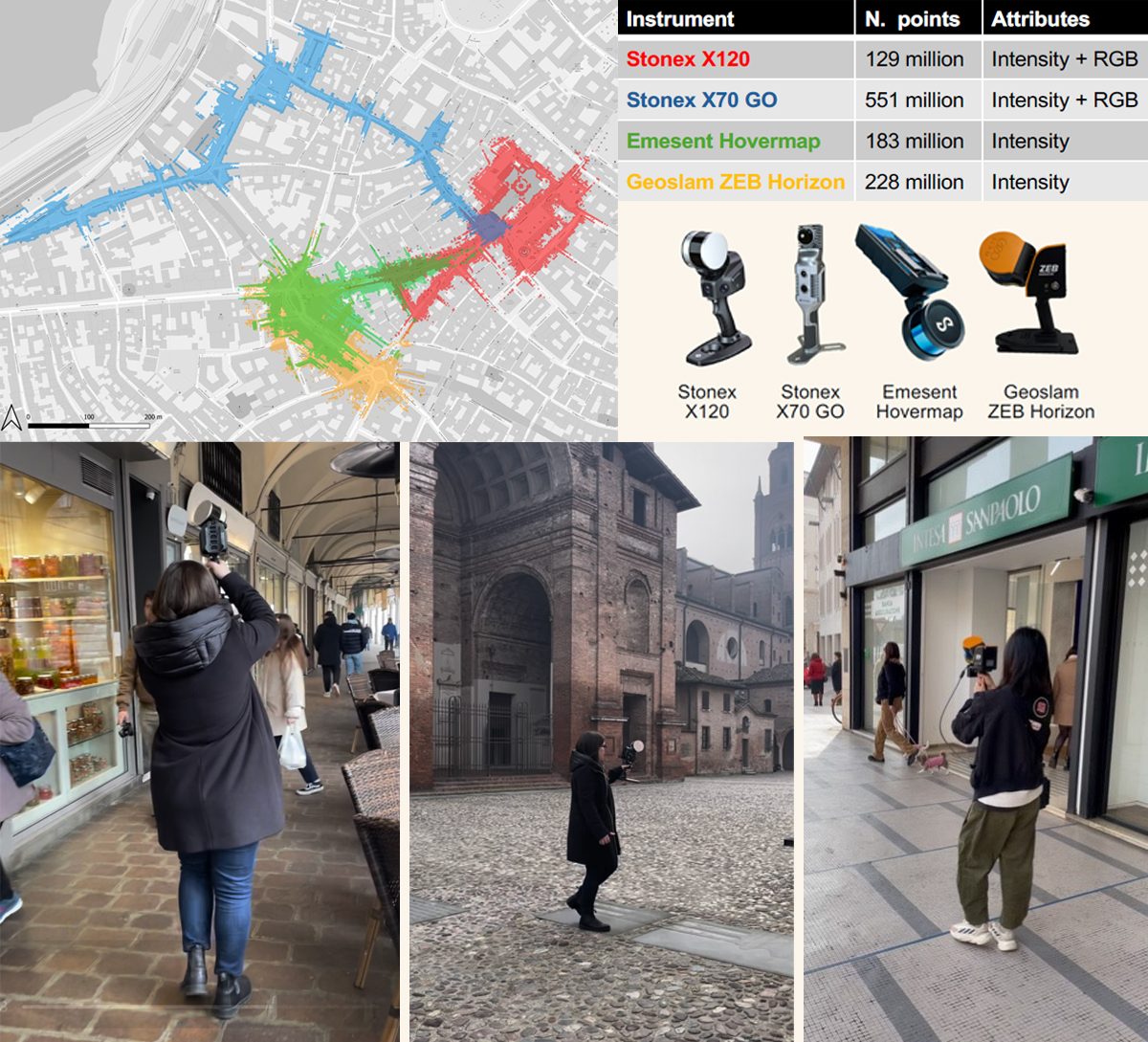
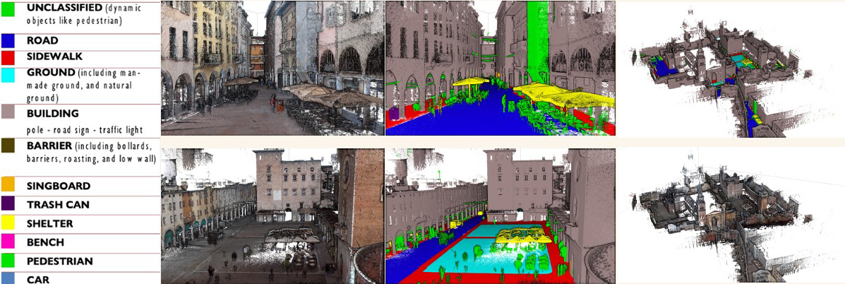
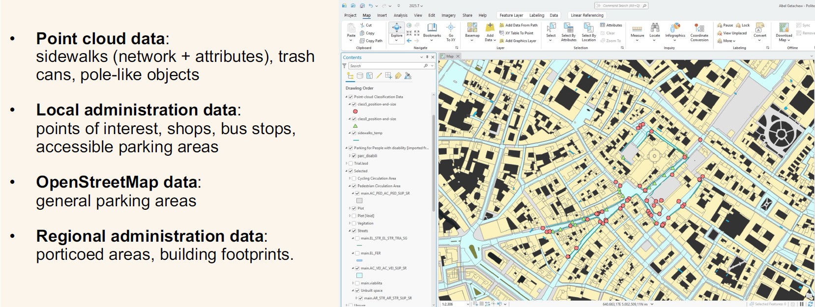
The case study is the historic centre of Mantua, a UNESCO World Heritage Site, surveyed using mobile laser scanning systems to produce high-density point clouds. These point clouds have been classified and analysed to extract parameters relevant to accessibility, such as pedestrian path geometry, gradients, level changes, urban furniture and covered areas (arcades represent a particular case in the study of urban spaces, as they are ambiguous in their spatial definition).
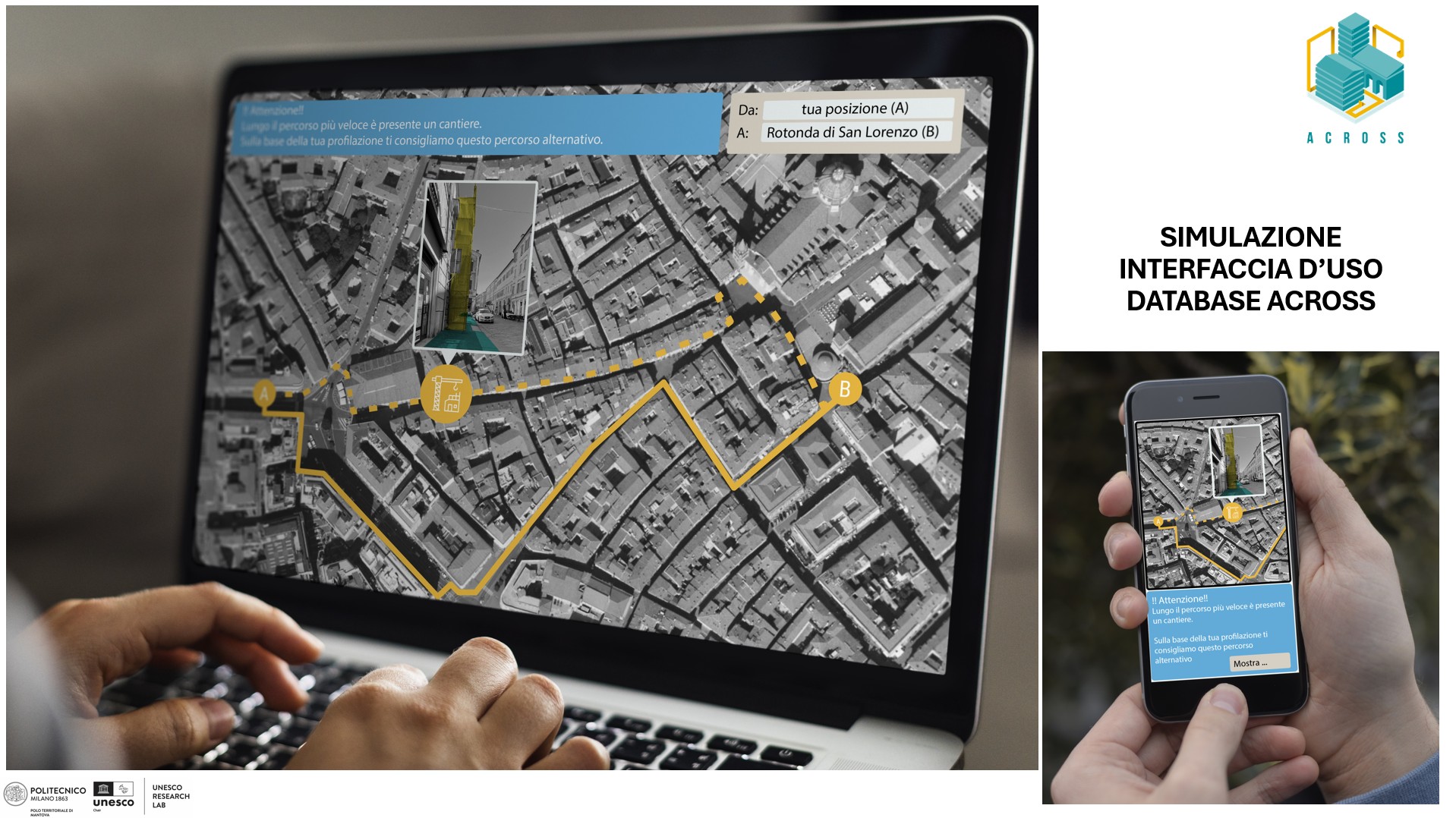
From the acquired 3D database, key accessibility parameters have been extracted and integrated with GIS layers and open data, resulting in a platform capable of multi-criteria analysis, thematic visualisations and, in the future, personalised accessible route planning.
ACROSS contributes to the development of reliable, scalable tools to improve accessibility in historic contexts, promoting more inclusive cities and an informed experience of cultural heritage.
Attachments
 Publications
- Digitizing Physical Accessibility in Urban Scenes: From Point Cloud Processing to GIS-Based Analysis, ISPRS ARCHIVES, 2025
- The Significance of Porches in Urban Applications: A Method for Automated Modeling and Integration, ISPRS ARCHIVES, 2024
- Innovative Accesibility. Data inverntory tools for Urban Environments in Historic Sites, 2022